 [OC] Neighborhood Map of Scranton, Pennsylvania (2023)
Submitted by zorionek0 t3_11u1ugx in Pennsylvania
zorionek0 OP t1_jclwz5l wrote
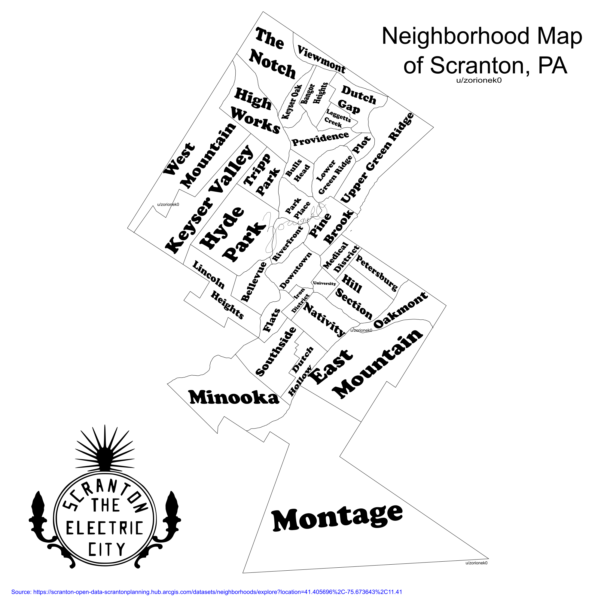
I made this neighborhood map based on Scranton City Planning's Scranton Open Data (arcgis.com). They've divided the city in 35 neighborhoods.
This was a fun little project, especially because I have never heard of some of these neighborhoods, but it doesn't surprise me that there are neighborhoods with like 30 houses in them.
Some fun little quirks of the map: East & West Mountain neatly show the geography of the valley, and then the Lackawanna river cutting through the city is clear in the shape of some of the other neighborhoods, for example the edge of Minooka.
Iron District I was tempted to call The Furnaces, which is how I always thought of that, but Iron District makes sense too.
Montage is wide open but it also has the baseball stadium, ski resort, shoppes, and some other cool stuff.
zorionek0 OP t1_jclz4aj wrote
Edit: LOL in the /r/Scranton post the very first comment is someone telling me I missed two neighborhoods. I love it- nothing riles people up like neighborhood geography
Viewing a single comment thread. View all comments