Submitted by two_plus_two_is_zero t3_yetjh6 in dataisbeautiful
Submitted by two_plus_two_is_zero t3_yetjh6 in dataisbeautiful
What about Antarctica, I heard its the contiennent with the highest elevation. 🇦🇶
Not a country.
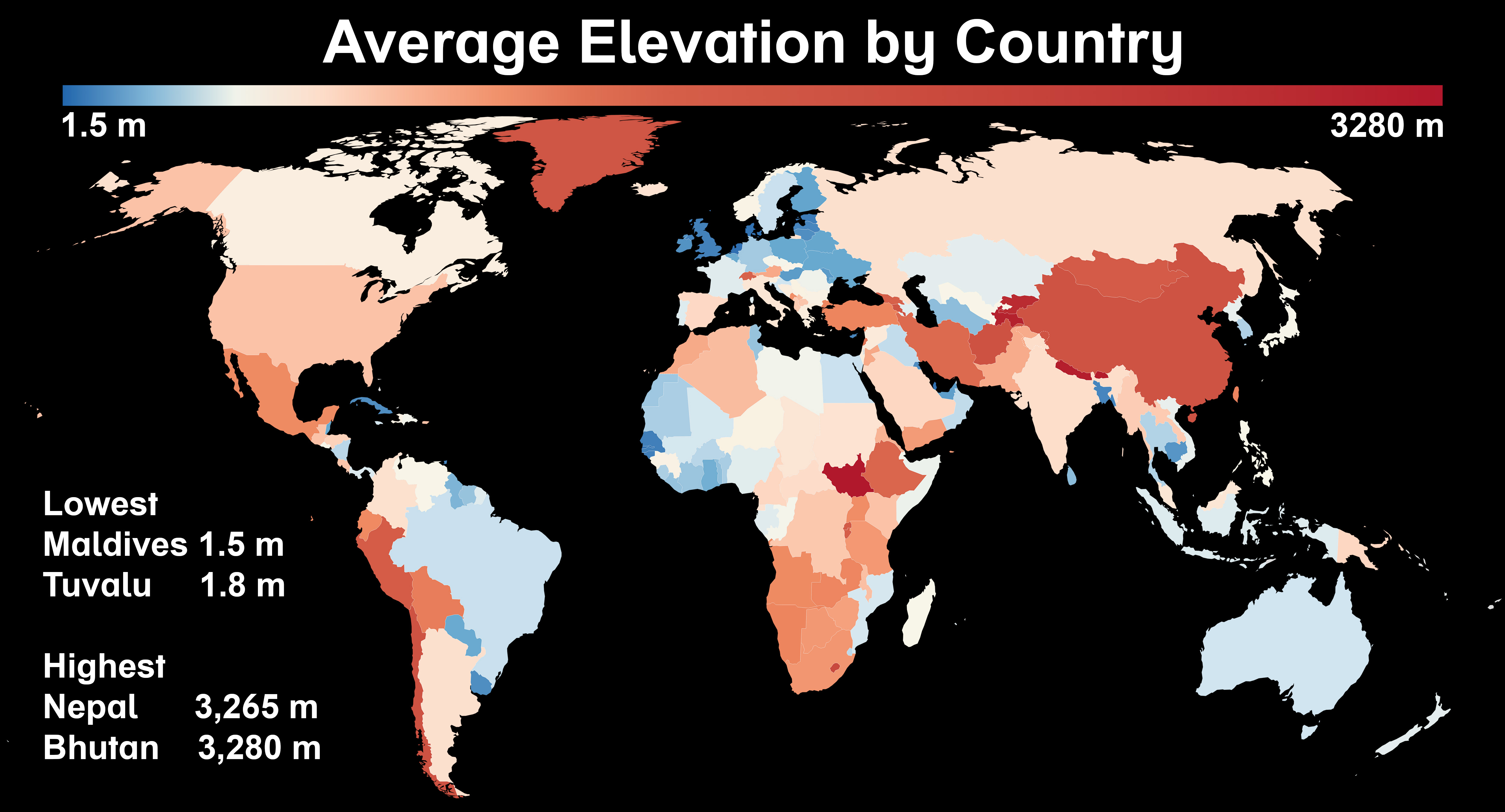
China and Greenland surprised me, as did Eastern Europe. Nice graph!
I think Greenland is more surprising, when you remember the Tibetan Plateau is in China then that makes a lot of sense.
Maldives the lowest
And Bhutan the highest
#Well, that escalated quickly.
Seems like useless information.
Highest point of Finland is on a slope of a small Norwegian mountain.
Technically Greenland should be the same color as Denmark.
The Netherlands are way higher than that.
[removed]
For China its the region of Tibet that increases the average I guess.
What is happening with Great Britain.
[deleted]
Haha, we are not here to learn applicable stuff!
Suggestions:
Decoupling elevation from geopolitical boundaries may allow more of the detail to show through, if that's desirable. One colour per country is quite a coarse quantisation.
Try generating per-pixel rather than per-country average elevations and use a carefully chosen contrast colour to draw national boundaries.
Perhaps consider switching from the current blue-white-red colour mapping to an alternative with a couple more hues, continuing to account for people with colour perception differences.
Compressing the blue-white range as you have for differentiating commonly-occurring low elevations does add some visual clarity. However there's a tradeoff with the linear consistency of the scale (outcome: distinguishing mid-range and higher elevations is harder).
The maps and atlases in your local public / school / college library (or other cartography resources online) may be helpful.
Here's a classic legend generator: ColorBrewer: Color Advice for Maps
Almost 30% of China is the tibetan plateau...
You can't really separate Greenland from Denmark proper in a map of sovereign states
two_plus_two_is_zero OP t1_itzrwpb wrote
Source: Wikipedia
Tool: Datawrapper