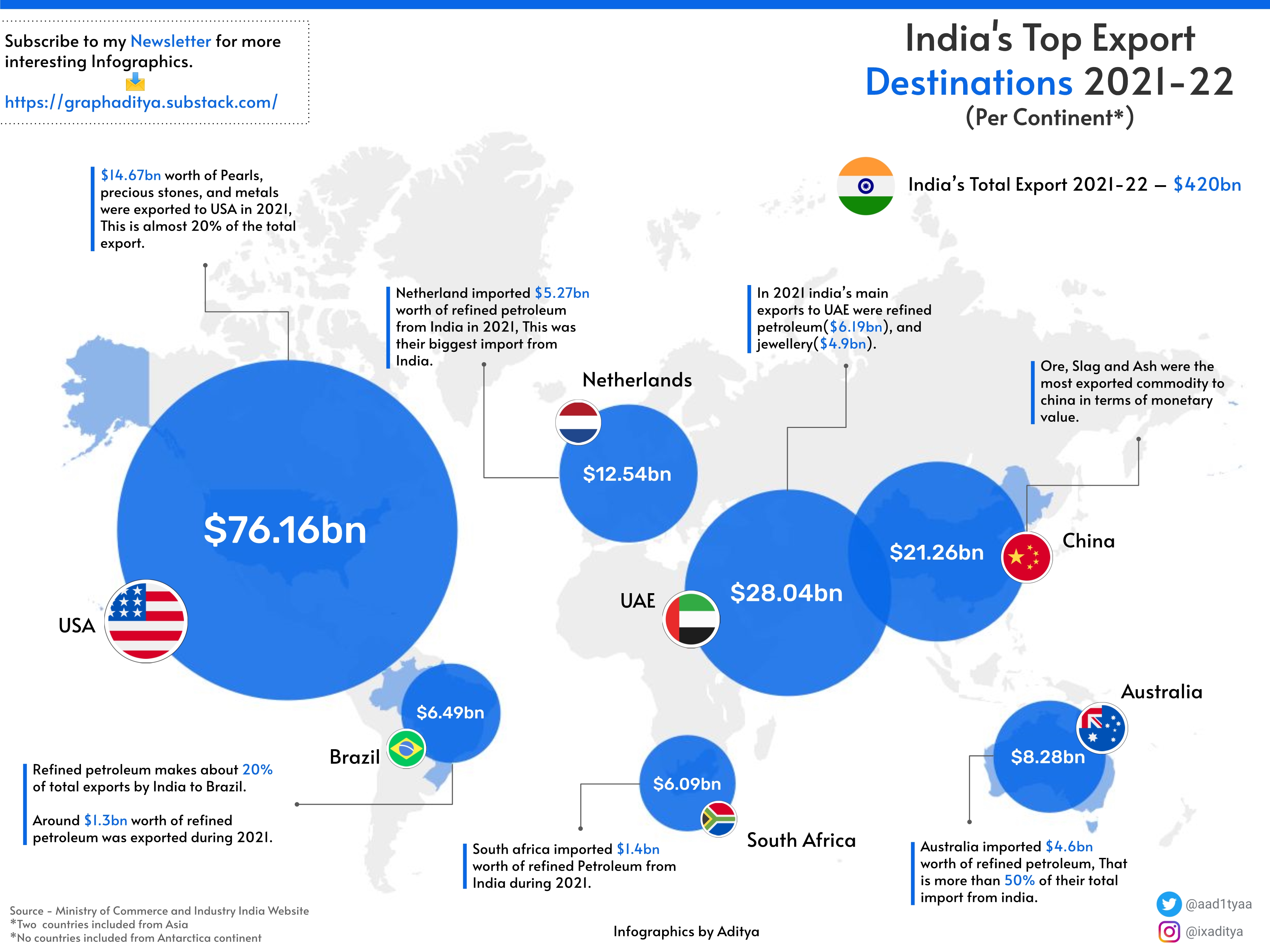
 India's Top export destination per continent [OC]
Submitted by ixaditya t3_yol0en in dataisbeautiful
BadBunnyYonaguni t1_ivfiqzd wrote
Reply to comment by IkeRoberts in India's Top export destination per continent [OC] by ixaditya
The Mercator projection is completely fine, people just use it in the incorrect ways. The map projection was designed for naval navigation, and it works perfectly as such a map. But since it’s so common, people started using it as a catch all map. I don’t really get why it matters if some countries are smaller? Does national pride get hurt? Just odd. I’m British Indian fwiw.
IkeRoberts t1_ivfoo23 wrote
If the map is about exports from India, then a projection that represents India accurately and centrally should be a priority.
For data visualization (for which r/dataisbeautiful is a showcase for best practices), it is good to spread out the informative material and minimize (or peripheralize) the unimportant. A projection that wastes half the space on parts of the globe that are not part of the story fails to do so.
Viewing a single comment thread. View all comments