 Opinions on Niche's Baltimore Neighborhood ratings? Any neighborhoods you strongly disagree with the ratings on?
mightyIllusion t1_j7dbrrn wrote
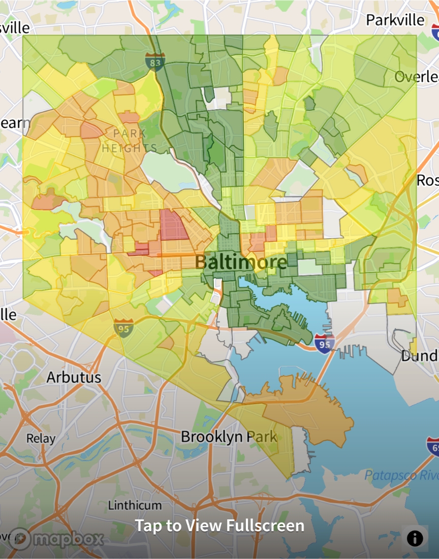
It's certainly indicative of the L and butterfly....
Keyserchief t1_j7dxszn wrote
Based on r/baltimore's recommendations for local businesses to go to from this post two days ago, it sure looks like this sub concurs with these ratings.
mightyIllusion t1_j7e00og wrote
So, this sub is overwhelmingly white and liberal.... not too much of a shock with the correlation there
Keyserchief t1_j7fhdek wrote
I don't know that it tells us anything about the sub's politics. Based on where it tells us users live and spend their time, I'd go so far as to say most are white, but it doesn't say anything about that definitively.
I think what that map does tell us is that users overwhelmingly live and spend their time in the affluent neighborhoods in green on the Niche map. More importantly, though, consider all of the discussion in r/baltimore on the problems facing communities in the east and west of the city. I think that that map is evidence that users overwhelmingly don't visit those parts of town, most of them ever, which calls into question how useful their perspectives are.
Like, people in this thread are calling this a redlining map, and that could be very true, but have you tried mapping out where you spend your time and money? Evidently, it might look just like this.
HeGotTwo t1_j7faz72 wrote
Wow. Did you get that brush a Home Depot? You can paint a whole room with one stroke
weahman t1_j7fcoyf wrote
"overwhelmingly" they did not say all.
I'm going to guess they probably used a roller at minimum vs a brush. Here's some handy tips for future painting.
https://www.familyhandyman.com/project/painting-tips-how-to-paint-faster/
jayknow05 t1_j7fy09p wrote
It's pretty accurate IMO, neighborhoods across Northern Pkwy down to E 33rd are also solid, which is not part of the "L". Northwood, Perring Loch, Penn Lucy, areas around Morgan State are some examples; mostly "B's" since there aren't a ton of businesses, but affordable areas with good people.
Viewing a single comment thread. View all comments