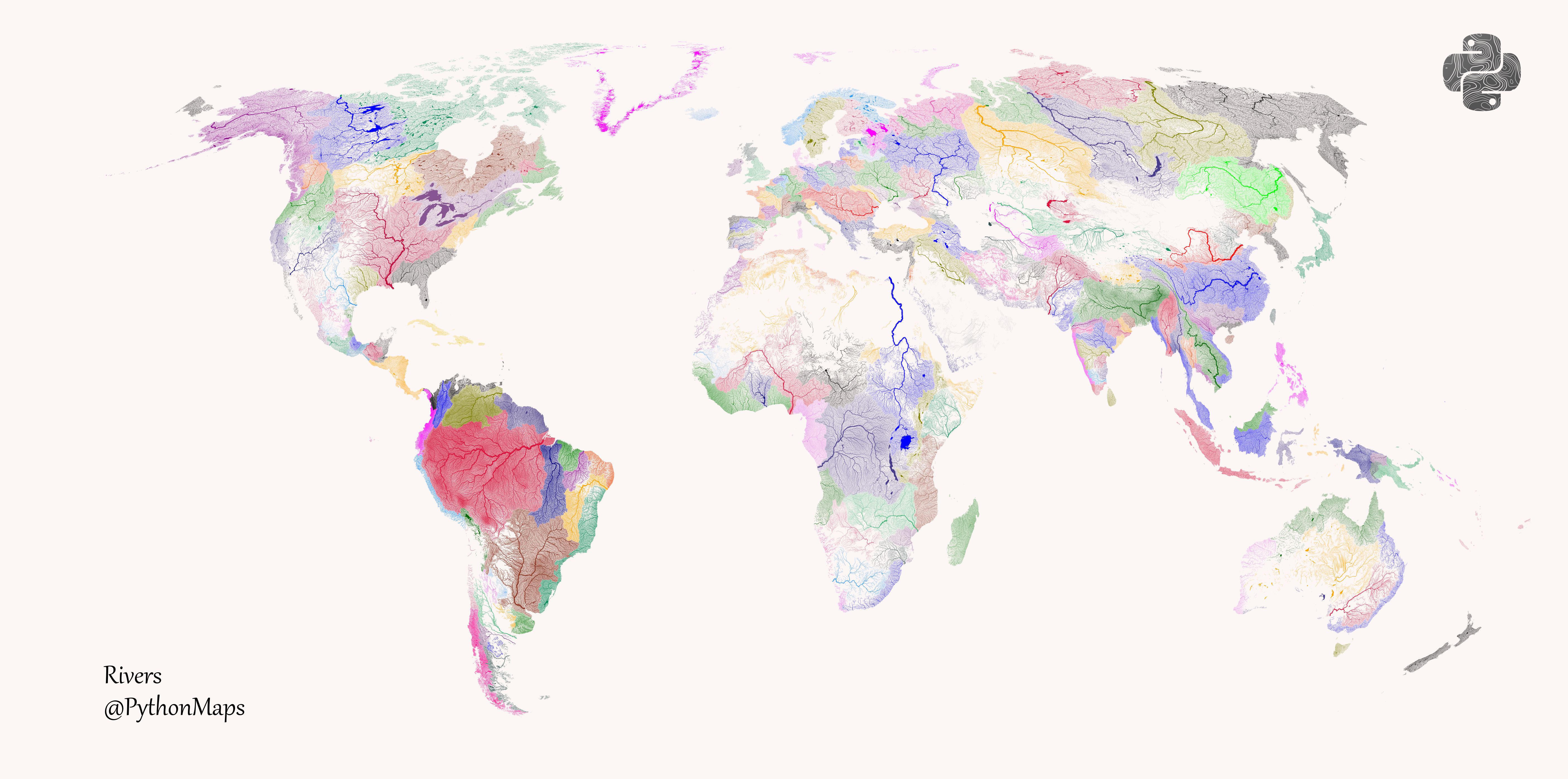
 Rivers of the World! coloured according to the major hydrological basins they are part of. [OC]
Old_AP_Pro t1_j6umw5y wrote
Reply to comment by Tracorre in Rivers of the World! coloured according to the major hydrological basins they are part of. [OC] by symmy546
There are 10 river basin districts in England.
Anglian, Dee, Humber, North West, Northumbria , Severn, Solway Tweed, South East, South West, Thames
Therefore, England should have ten colors, not one as shown on this map.
Tracorre t1_j6uq263 wrote
Well yes, but if it did that it would be creating very small river basins all along various coastal areas. All of the US coasts have this same issue, and much of the African coasts and SouthEast Asia, etc. There is a grouping compromise being done somewhere to prevent having so many small basins. A map of this type of just one country could split them up, but whole world would be just too busy.
Old_AP_Pro t1_j6w3jyq wrote
Italy is split ip to east and west coast. Roughly the same size as England, and smaller than England, Scotland, Wales combined.
Greenland, Sweden, Norway also wrong.
[deleted] t1_j6we9pz wrote
[deleted]
Old_AP_Pro t1_j6uqpdh wrote
There is no way All of the rivers in England belong to the same hydrological basins. The Thames, east coast is very distinct to the Severn, west coast.
itsalilbitlit t1_j6v6bqz wrote
You obviously did not comprehend the comment you responded to...
[deleted] t1_j6v9dot wrote
[removed]
Viewing a single comment thread. View all comments